Geospatial Data Acquisition & Processing
- Administrative Boundaries
- Vector datasets (Roads, Building footprints, Point of Interest )
- Raster datasets (DTM, DSM, Satellite Imagery, Aerial Imagery)
Administrative Boundaries
This provides information on the delineations of the existing boundaries of States, LGAs and Wards across Nigeria. Progis supplies this dataset in vector format

Figure 1: Administrative boundary of Lagos State with the 20 LGAs
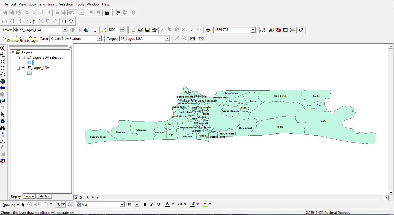
Figure 2: Administrative boundary of Lagos State with the 57 LCDAs
Street Level Map Datasets for Major Cities and Towns
Typically, this contains details of streets – express ways, highways, major and minor roads. The attributes of these features are used to build database tables which are useful for spatial analysis, planning and effective decision support processes.
For example the locations of base stations and other POIs collected on project are better appreciated when viewed together with street-level map data. Data is supplied in vector format.
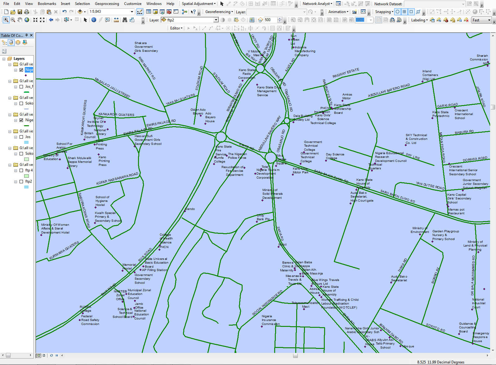
Figure 3: Street level map of Kano (portion of)
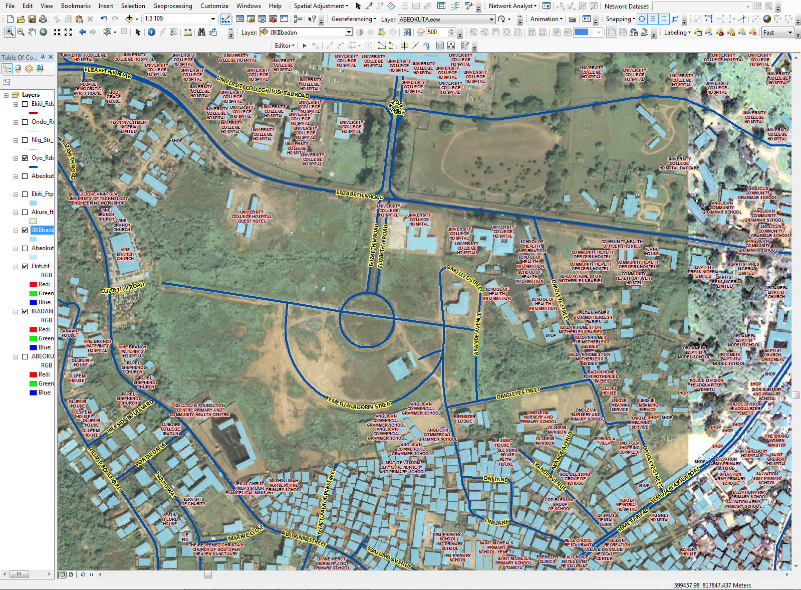
Figure 4: Road Network and Building Footprints in Ibadan (Portion of) overlaid on high resolution satellite imagery
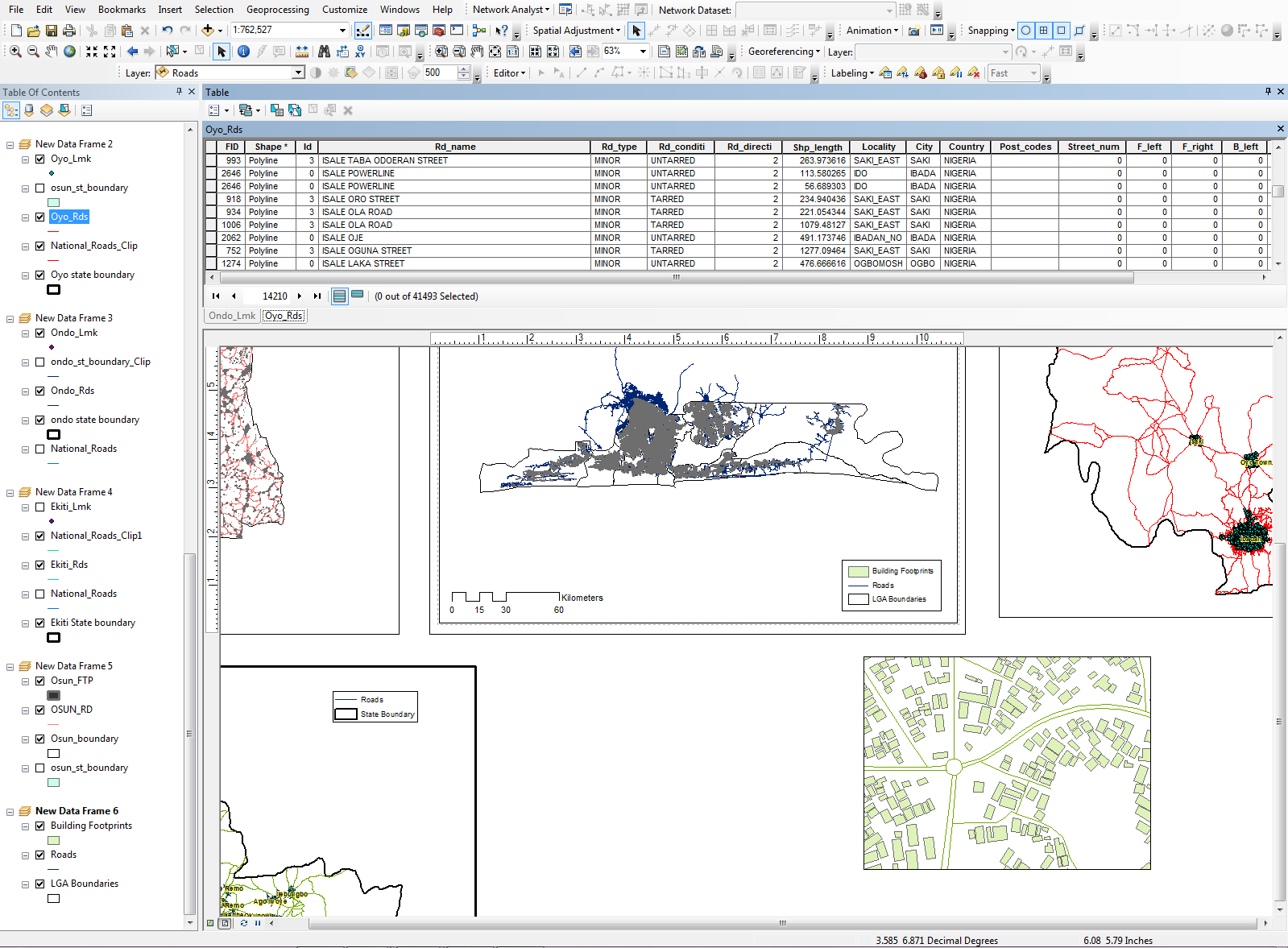
Figure 5: Table structure of our road network data
Points of Interest (POIs)
These are landmarks that are located at strategic positions; usually a combination of natural and man-made features and can be found almost everywhere. There are several categories including but not limited to: Club/Social Organization, Corporate Organization, Eatery/Restaurant, Educational Institution, Estate/Major Building, Industry, Government Parastatal, Health Facility, Historical Monument/Artifacts, Market, Public Facility, Telecoms Infrastructure, Recreational Centre, Place of Worship, Settlement, Telecommunication Mast, Natural Features, etc.
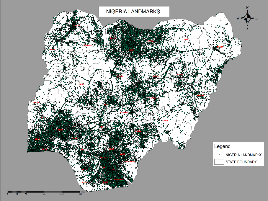
Figure 6: POIs, Road Network and Building Footprints for a portion of Ondo Town overlaid on high resolution imagery
Clutter Map of Nigeria
Clutter map is used in all of today’s state-of-the-art radio frequency (RF) propagation tools to model path loss, signal attenuation and frequency re-use. A system designed with accurate geodata will result in reduced costs for infrastructure and drive testing, as well as more reliable network performances. Data is supplied in vector format.
Building Address Database and Terrain Models (DTM & DSM)
Building Address Database comprising of information on building outlines, building addresses, X, Y Coordinates, use and height for major cities and towns across the federation. This data will assist the Transmission Planning Unit in line of sight (LOS) analysis as well as improve coverage prediction of signal attenuation for Radio Frequency and planning.
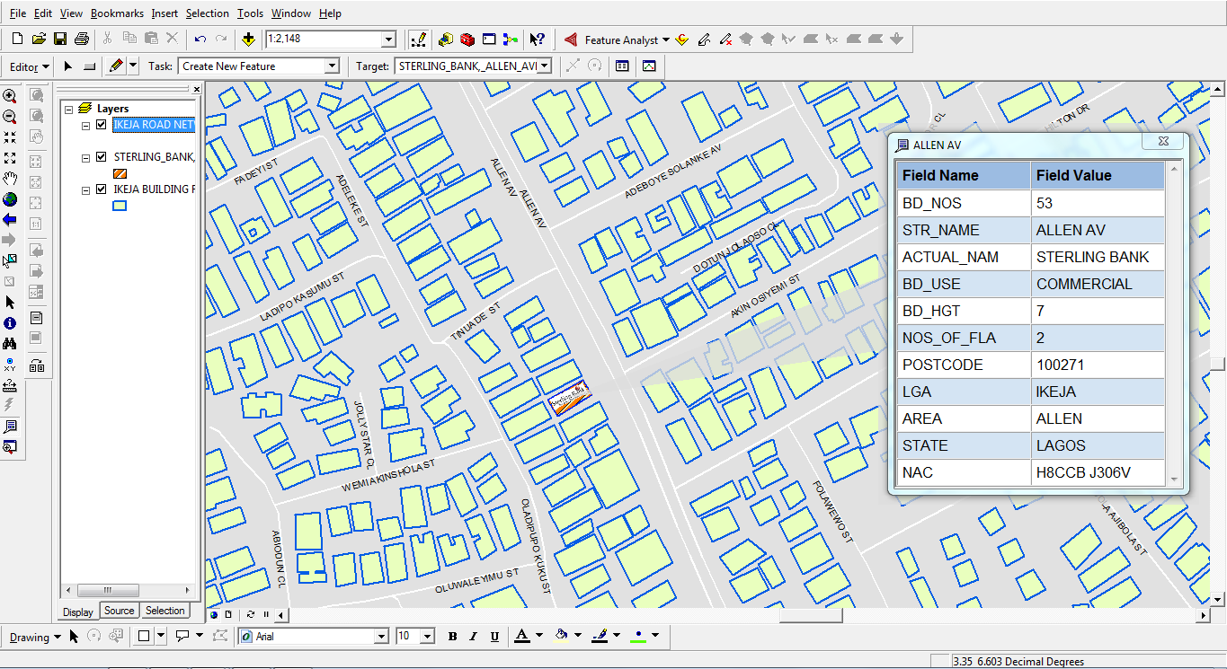
Figure 7: Building Address Information for Ikeja Area (portion of)
Digital Terrain Model (DTM) is a 3D representation of the earth’s surface, it represents the height information of the bare ground surface without any objects like plants and buildings. A combination of the building address database and the digital terrain model gives a Digital Surface Model (DSM) which is a representation of the earth surface and the built-up structures on it including buildings, vegetation, powerlines, etc. DTM& DSM are key requirements for RF Planning and Transmission Modeling.
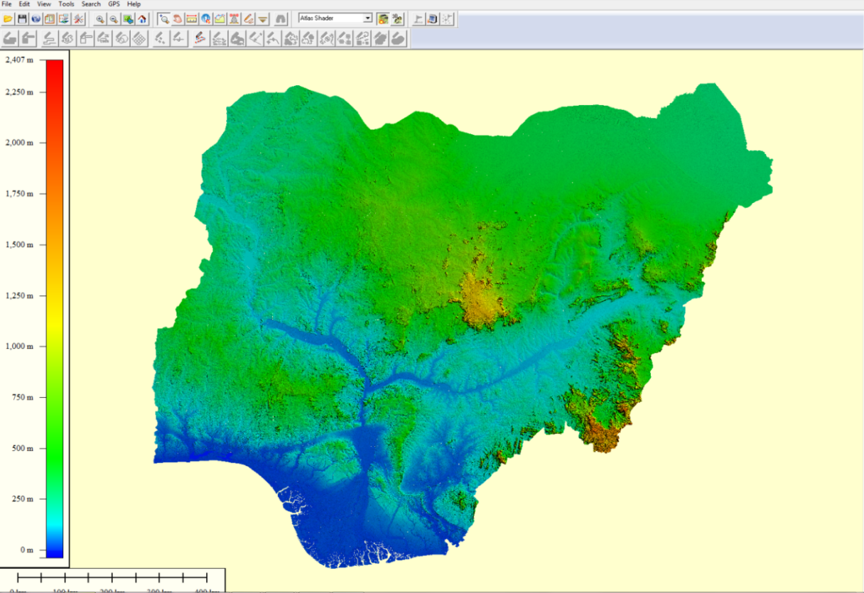
Figure 8: Digital Terrain Model (DTM) of Nigeria
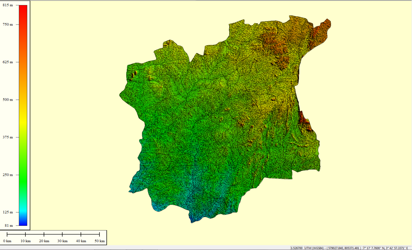
Figure 10: Digital Terrain Model (DTM) of Osun State
The 3D Building model displays height information of the buildings in the coverage area of interest. This would enable our clients to visualize height information critical for line of sight analysis and also estimate number of customers based on number of flats in a building
This system would help to seamlessly handle the challenges of Horizontal Geographic Codes (HGC) and/or Vertical Geographic Codes (VGC) used to translate Consumer and Billing Addresses into a 10-digit system-generated alphanumeric code. The HGC is applicable to residential or commercial buildings having one metering point, and for multi-level buildings with different electric users on each floor, the VGC is added to HGC for additional reference
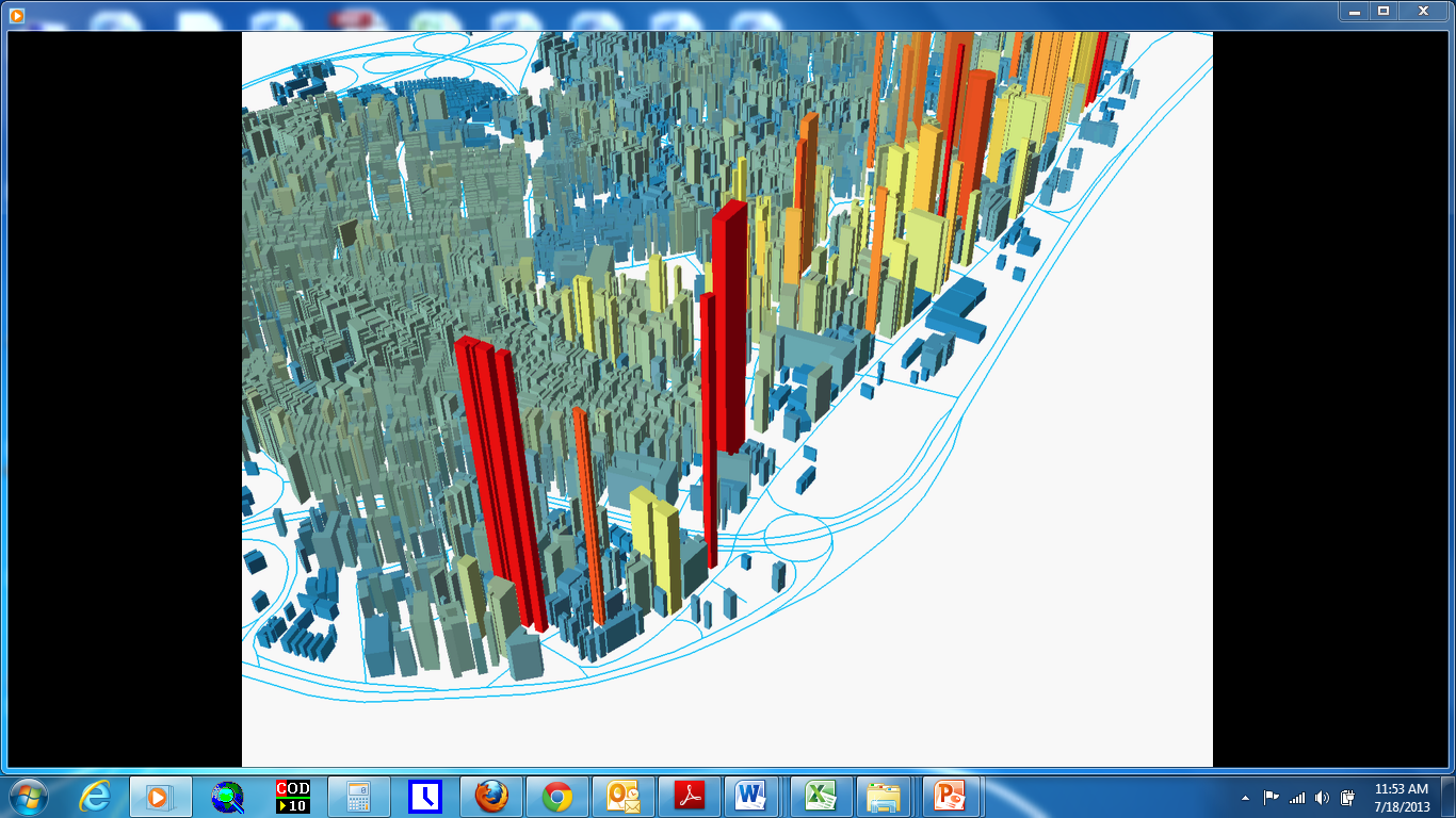
Figure 9: A 3D Model of Buildings in the Marina area, Lagos Island LGA (portion of)
