Enterprise GIS & Location Intelligence Solutions
- Deployment of EGIS application
- Deployment of Coverage Locator application
- Deployment of Land Information systems
Enterprise GIS Solutions
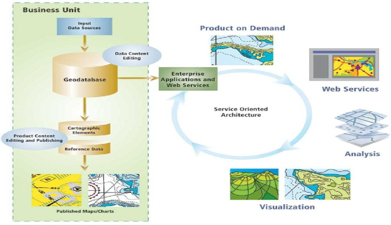
Enterprise GIS application provides broad access to geospatial data/services across client’s departments thereby enabling location intelligence within the organization. It is an architecture that integrates geospatial data and services and shares them across the organization. It provides interface for multiuser access to both spatial and non-spatial data
It can also be viewed as an infrastructure that extends and enables existing enterprise systems using geospatial data and services. The basic idea of an enterprise GIS is to address the needs of departments collectively instead of individually. The development of one comprehensive infrastructure minimizes potential conflicts and misunderstandings and can result in significant cost savings and performance improvements. It is also important to manage the spatial data in Enterprise GIS. For these purposes, we have the relational database systems such as Geodatabase, SDE Layer that has security, multiple concurrent user access, spatial indexers that help in providing an Enterprise feature.
Benefits of Enterprise GIS Include
- High level of interoperability between GIS and non-GIS applications
- Improved enterprise-wide knowledge management and decision support capabilities
- Considerably reduced data redundancy
- Improved accuracy and integrity of geographic information
- Efficient and timely data sharing
- More effective use of departmental GIS skills and resources
- Improved enterprise-wide knowledge management and decision support capabilities

Figure 1: Integration capabilities of an Enterprise GIS
